1
/
of
8
ClassicReplacements
Framed Map Mappa Geographica Regionem Mexicanam et Floridam Germany c. 1730
Regular price
$1,499.99 USD
Regular price
$2,999.99 USD
Sale price
$1,499.99 USD
Unit price
/
per
1 in Stock
Couldn't load pickup availability
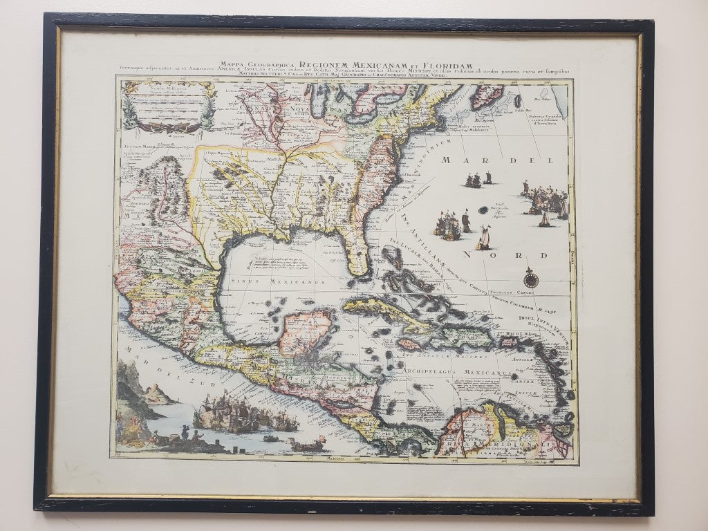
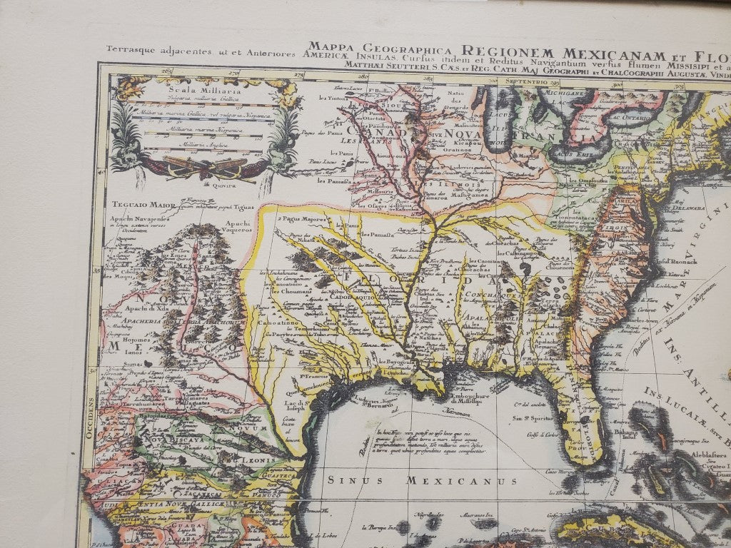
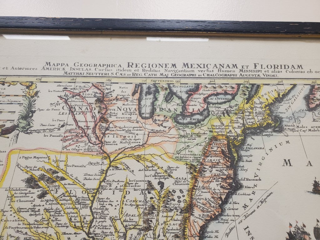
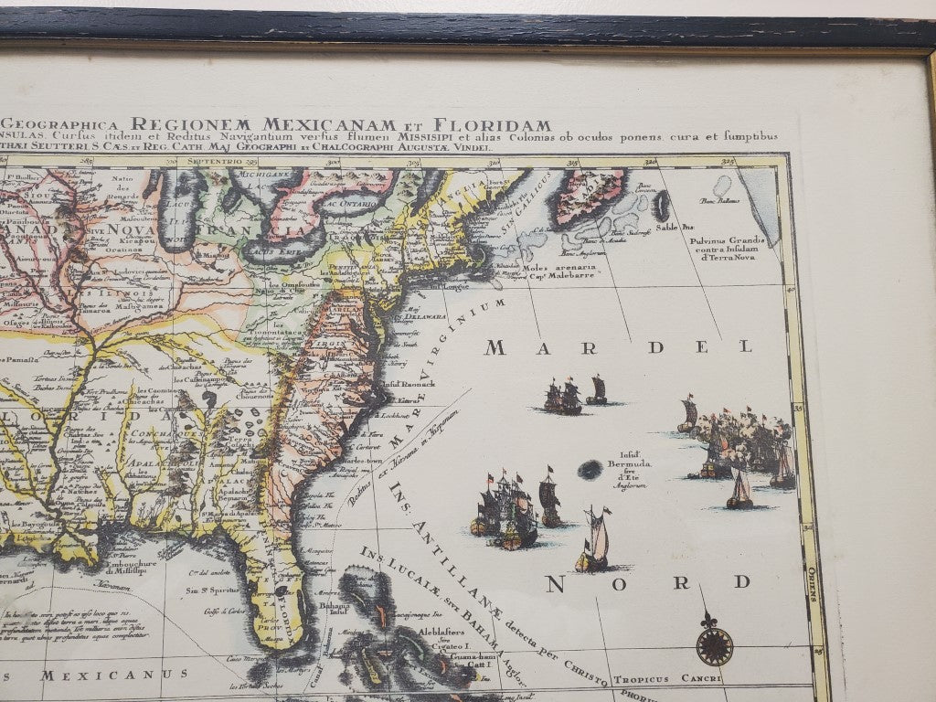
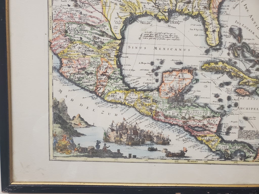
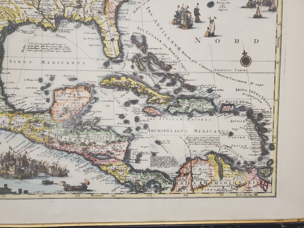
Framed Map Mappa Geographica Regionem Mexicanam et Floridam Framed Poster Map Germany c. 1730
Vintage map by a German cartographer illustrating France, Spain, and England's colonial territories. The map has a regal air to it: the text is all written in Latin, even going to the length of "Latinizing" the names Florida and Mexico-places the Ancient Romans probably never got around to naming. The details on the map really demonstrate the master craftsmanship of 18th Century cartographers. The naval battle scene illustrated in the bottom left corner of the map adds a personal touch that today's mass-produced maps can never replicate.
"Tarrasque adjacentes ut et Anteriores America Insulas, Curfus itdem et Reditus Navingatium verfus flumen Missisipi et alias Colonias ob ocudos ponens cura et fumptibus."
Cartographer: Matthaus Seutter
Printed in Augsburg, Germany
Year: c. 1730
Share


